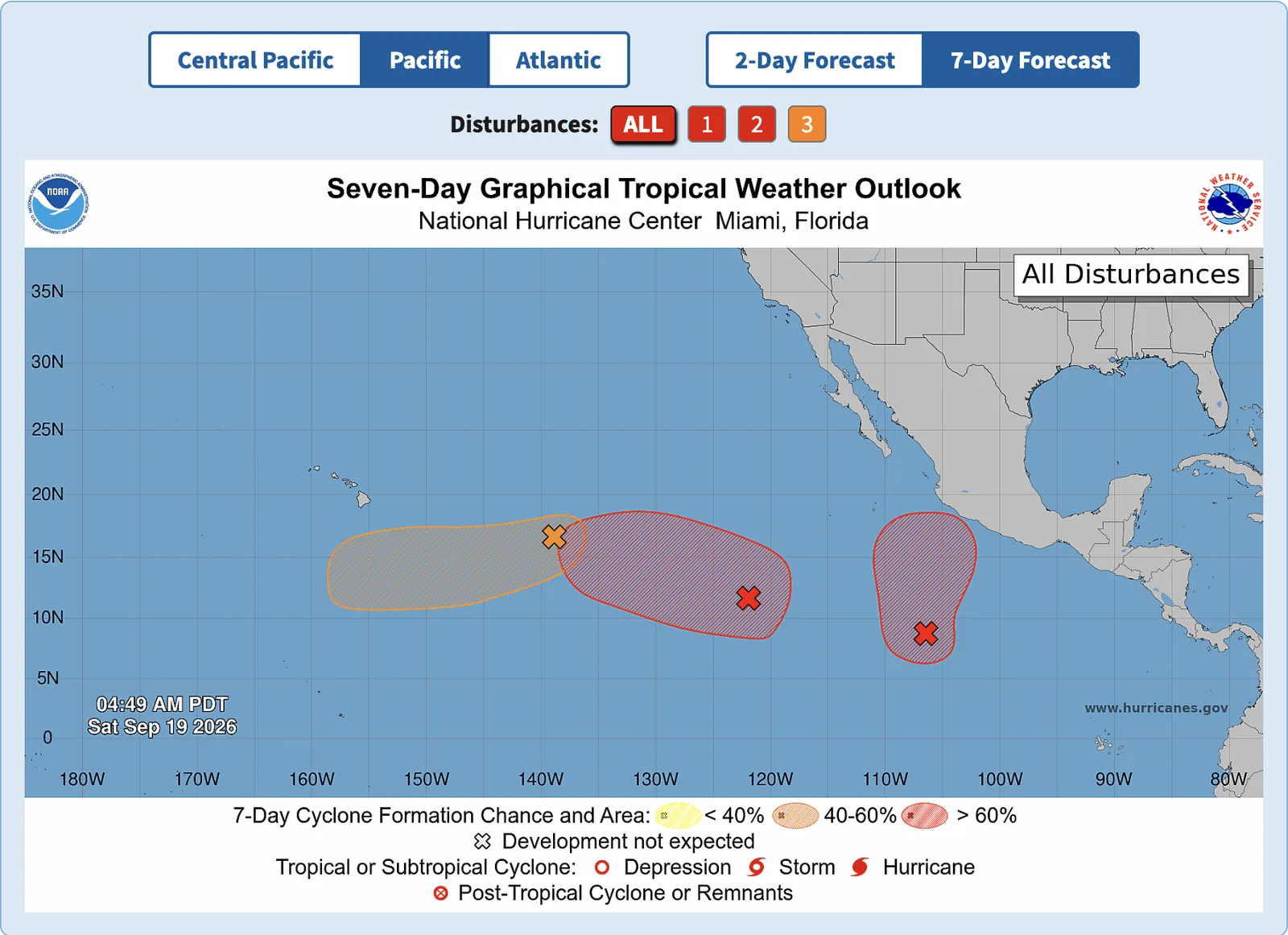

The East Pacific is carrying the week. Three areas under watch, two of them near-certain to become depressions in the next few days — one of them now at 90%. The Atlantic has a single system near the Azores, and it isn't expected to last long. Everything below is straight from the National Hurricane Center — no model speculation, just where things stand.
Neither Pacific system is named yet. Both are likely to be shortly. The next two names on the East Pacific list are Odalys and Polo.
Eastern Pacific
NHC outlook issued 5:00 AM PDT Saturday, September 19.
EP99 — south-southwest of southwestern Mexico
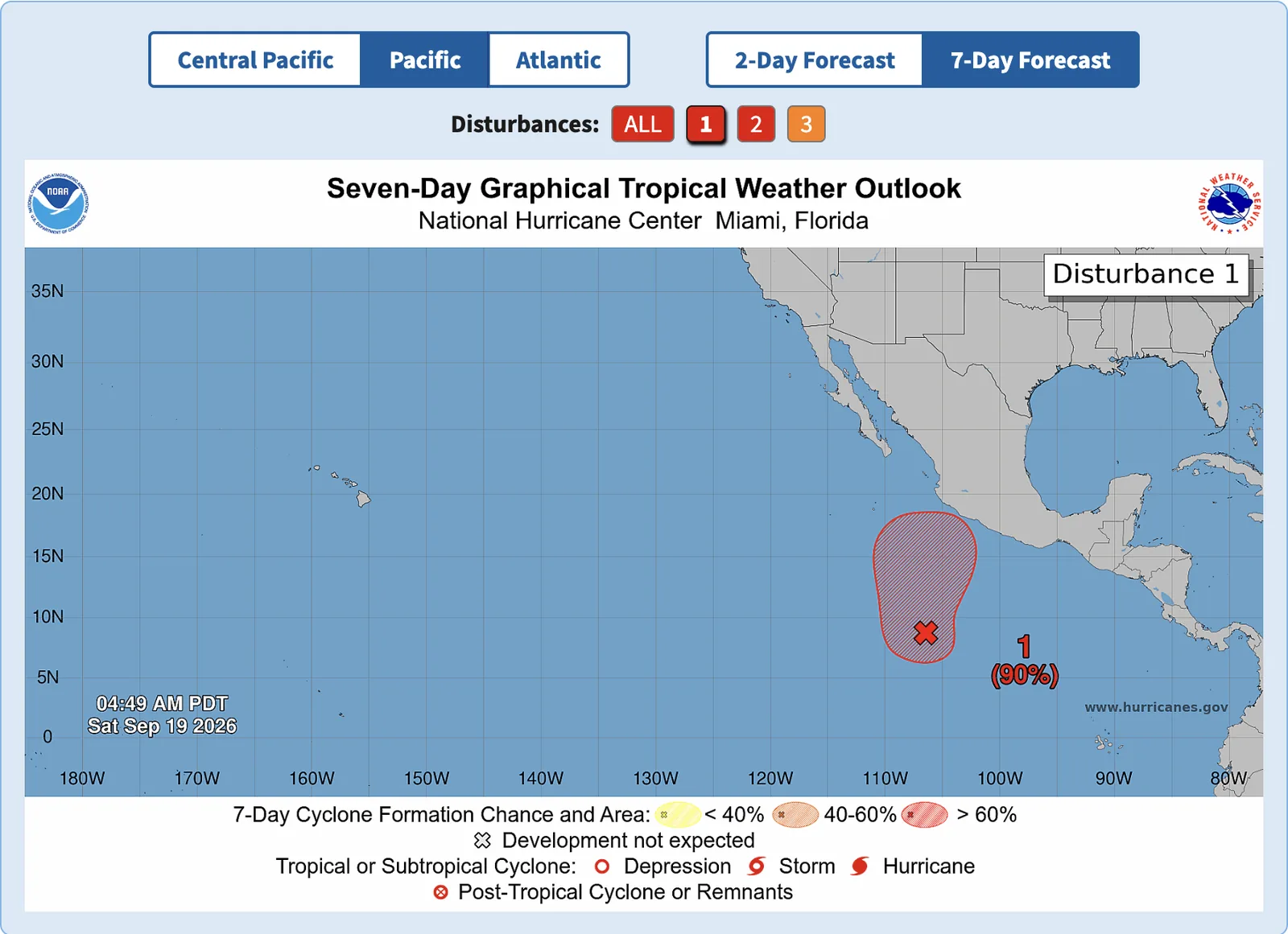
Recent satellite-derived wind data show the low well south-southwest of the southwestern coast of Mexico is still elongated, and the shower and thunderstorm activity remains disorganized. Environmental conditions are conducive, and NHC expects a tropical depression to form over the next couple of days as the system moves generally northward off the Mexican coast.
- Formation chance, 48 hours: 80% — high
- Formation chance, 7 days: 90% — high
- Movement: generally northward, off the coast of southwestern Mexico
NHC advises interests along the southwestern and west-central coast of Mexico to monitor this system.
EP98 — well southwest of Baja California
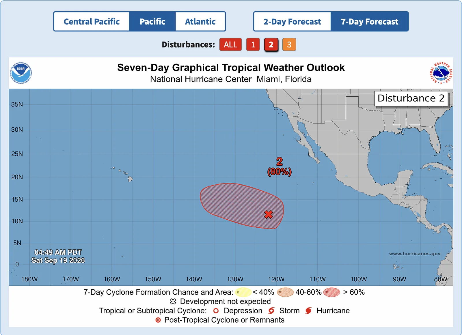
Disorganized showers and thunderstorms continue in association with an area of low pressure well southwest of the southern tip of the Baja California Peninsula. Conditions are conducive, and NHC expects a tropical depression to form over the next several days.
- Formation chance, 48 hours: 80% — high
- Formation chance, 7 days: 80% — high
- Movement: westward to west-northwestward at 10 to 15 mph
Remnants of TD 15-E — well east-southeast of Hawaii
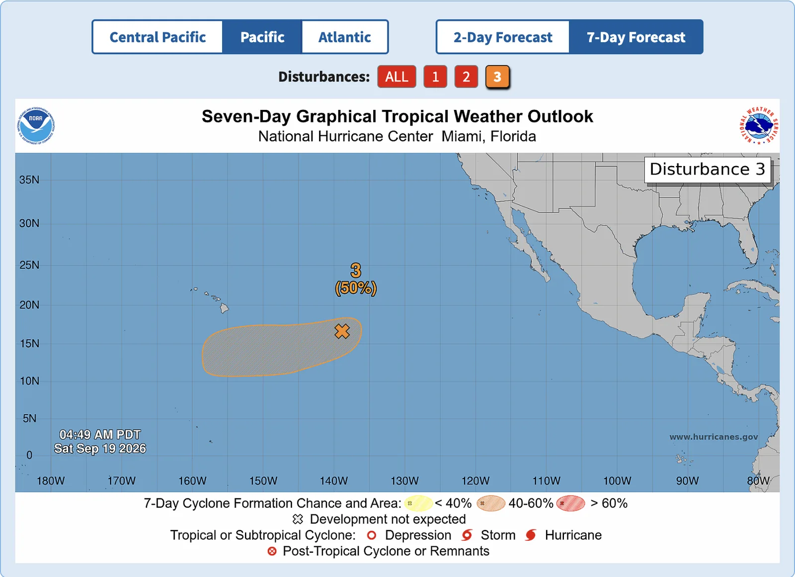
The remnants of Tropical Depression Fifteen-E are still producing disorganized convection well east of the Hawaiian Islands. Conditions look conducive for some development next week, with a depression possible well south or southeast of Hawaii toward the middle to latter portion of next week.
- Formation chance, 48 hours: 10% — low
- Formation chance, 7 days: 50% — medium
- Movement: westward to west-southwestward
Atlantic
NHC outlook issued 8:00 AM EDT Saturday, September 19.
AL99 — eastern subtropical Atlantic
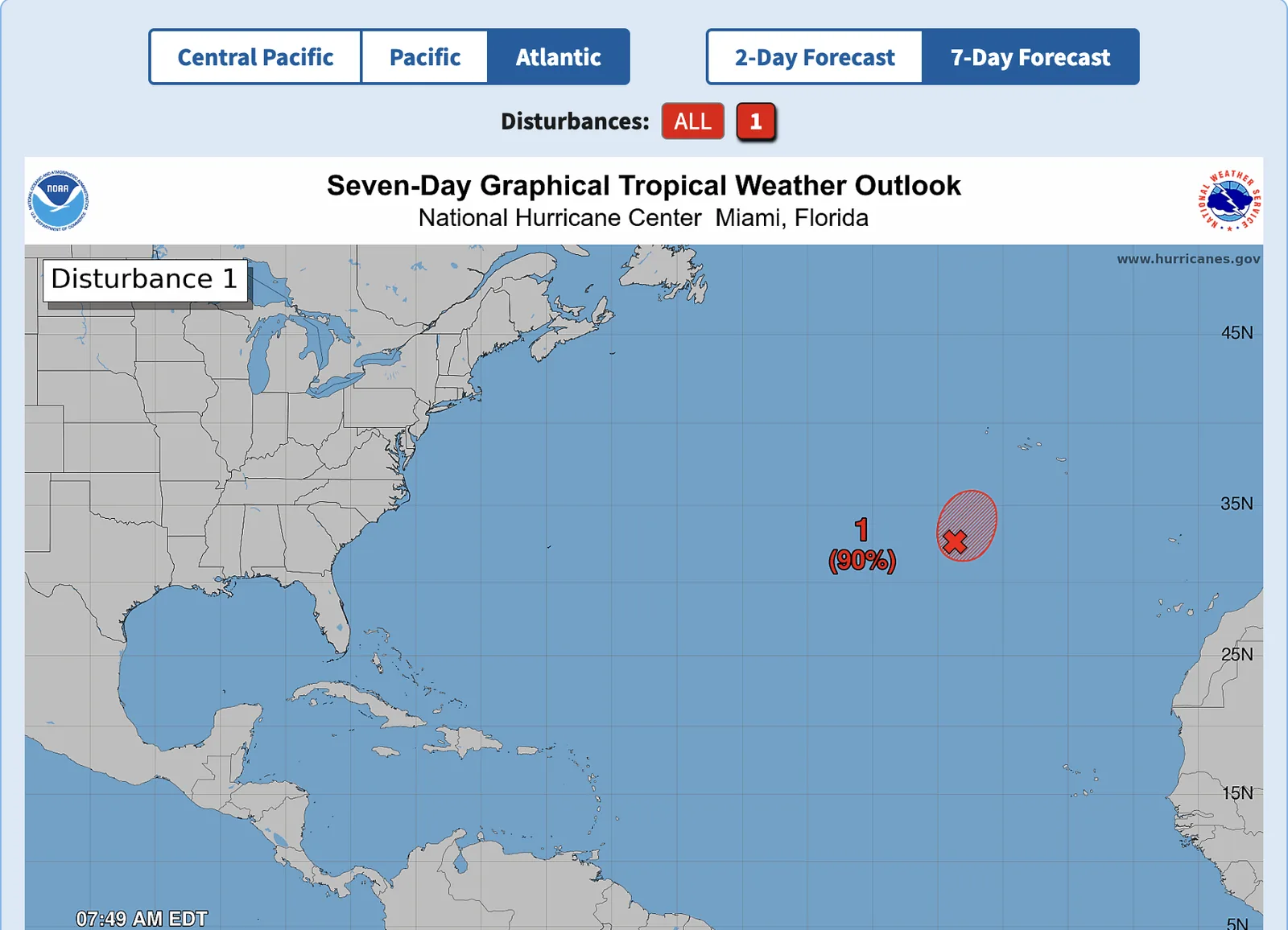
Showers and thunderstorms have become more concentrated near the center of a low pressure system several hundred miles southwest of the western Azores since yesterday. NHC expects a short-lived tropical depression or tropical storm to form later today or tonight, while the system remains well southwest of the Azores. Upper-level winds are forecast to become less conducive for development beginning late Sunday.
- Formation chance, 48 hours: 90% — high
- Formation chance, 7 days: 90% — high
- Movement: north-northeastward at about 5 mph
No other areas are under watch in the Atlantic, Caribbean, or Gulf.
Advisory data from the National Hurricane Center. Track the swell these systems generate in Fetch.