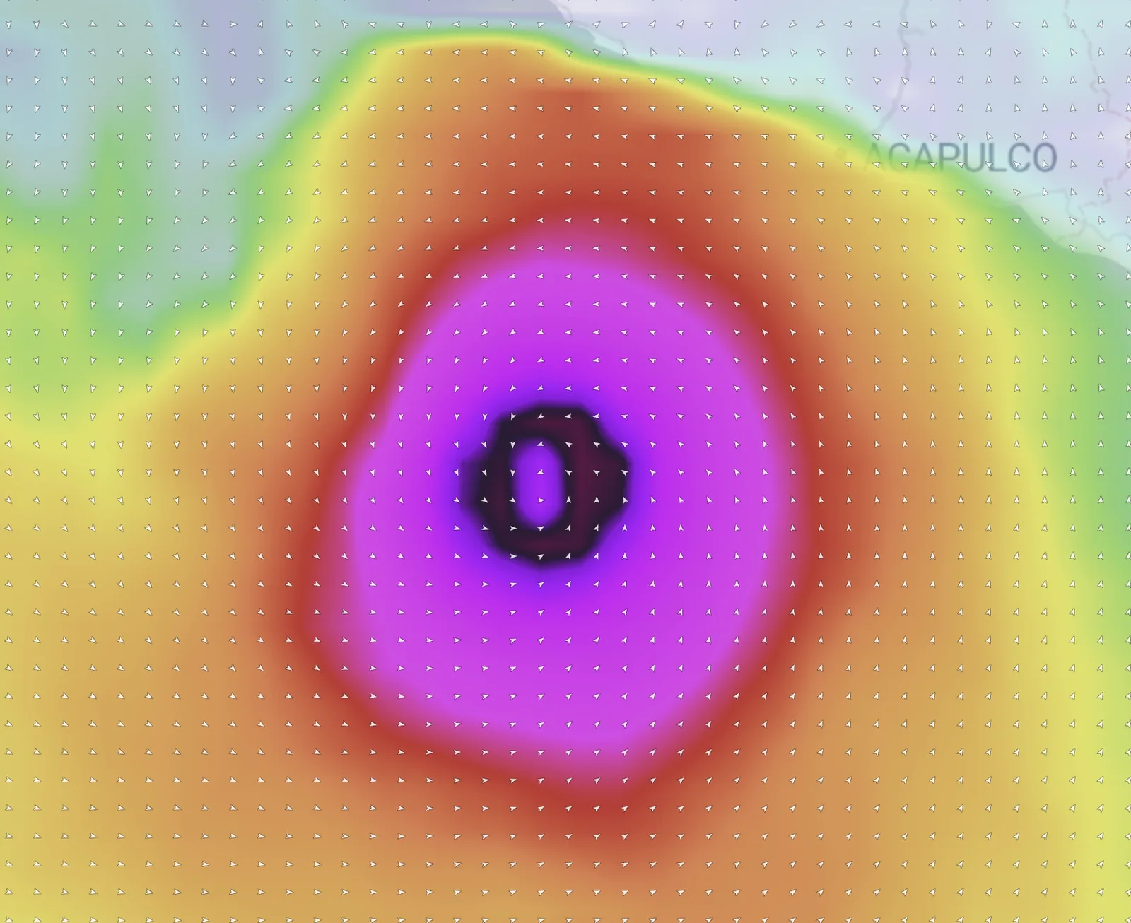

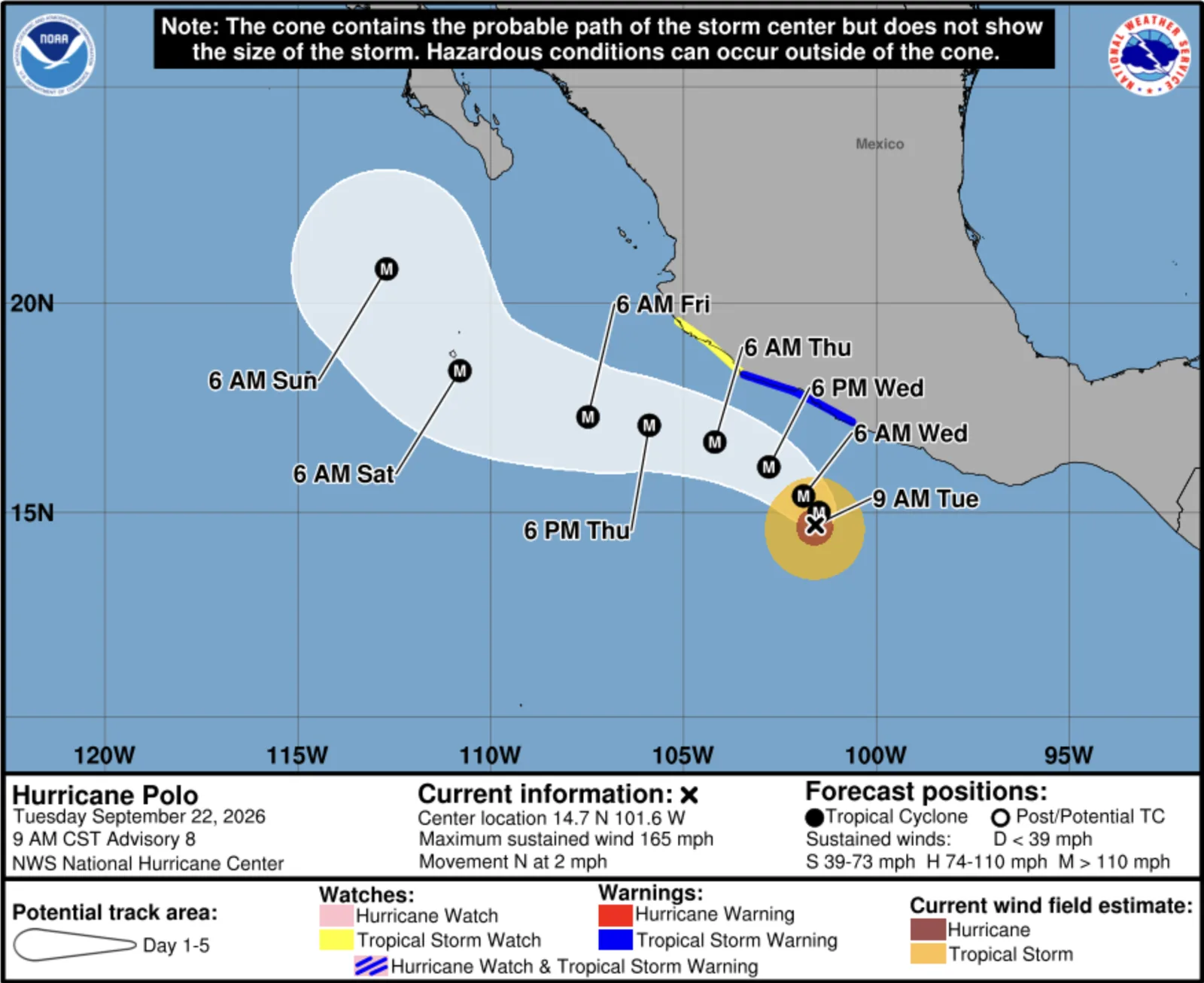
Three days ago Polo was an unnamed blob at 80% odds. This morning it's a Category 5 hurricane with a clear eye, 920 millibars of central pressure, and peak seas near 44 feet.
That escalation is the story. Polo's sustained winds climbed roughly 110 mph in 24 hours — the fastest intensification the East Pacific has seen since Otis in 2023, the storm that flattened Acapulco. It is the third Category 5 in the Eastern and Central Pacific this season, and there are still more than two months left on the calendar.
Where Polo stands right now
NHC tropical weather discussion, 16:05 UTC Tuesday, September 22.
- Position: 14.7°N, 101.6°W — roughly 200 miles south of Zihuatanejo, Mexico
- Intensity: 145 kt sustained (about 165 mph), gusting to 175 kt (200 mph)
- Pressure: 920 mb
- Movement: north at 2 kt — essentially crawling
- Peak seas: near 44 ft (13.5 m)
Satellite shows a clear, well-defined eye with very deep convection wrapping the eyewall. Strong convection extends up to 270 nautical miles from the center in the southeast quadrants. This is a textbook-looking major hurricane.
Where it's going
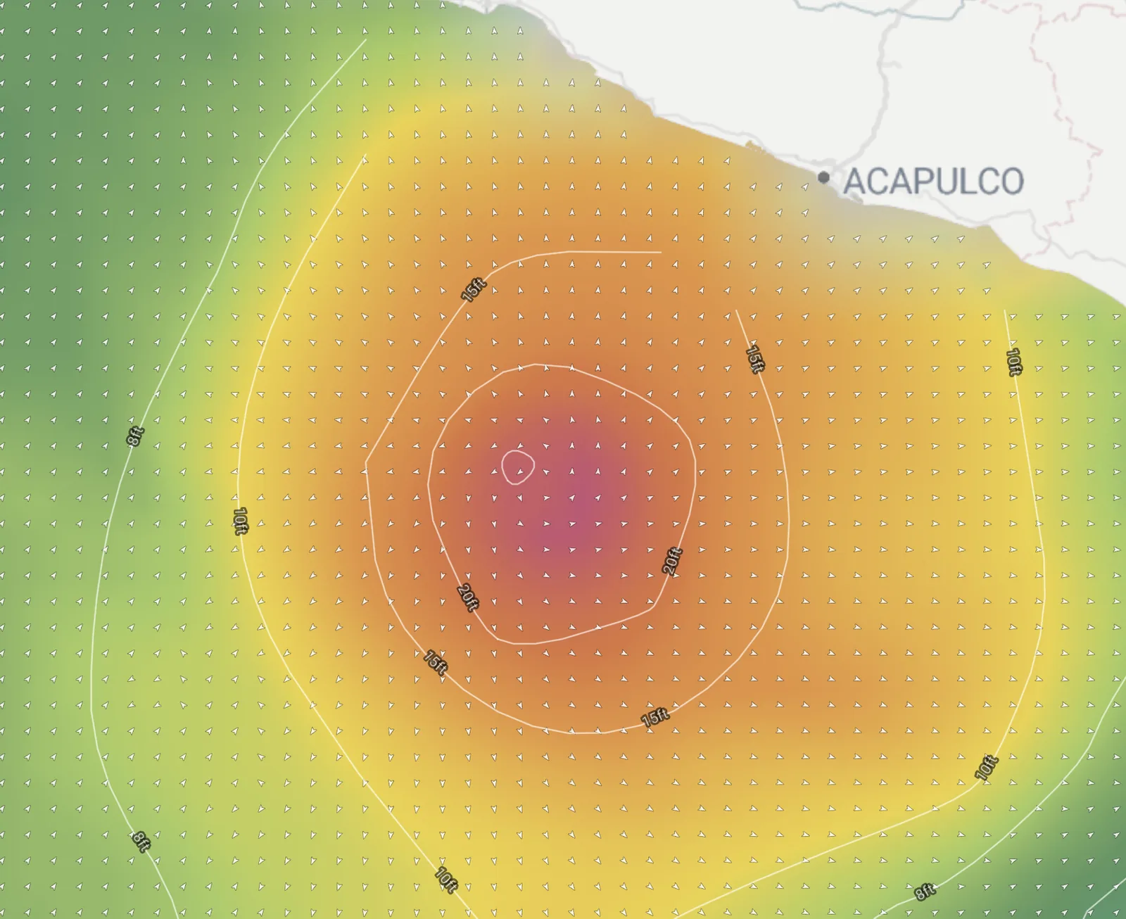
NHC has Polo turning toward the northwest and west-northwest tonight and Wednesday, with the core tracking near the coast of southwestern Mexico over the next few days — but remaining offshore. Some additional strengthening is likely through tonight, then fluctuations Wednesday and Wednesday night.
The forecast intensity ladder:
| When | Position | Sustained |
|---|---|---|
| Tue evening | 15.0°N 101.5°W | 155 kt (180 mph) |
| Wed morning | 15.4°N 101.9°W | 150 kt (175 mph) |
| Thu morning | 16.7°N 104.2°W | 140 kt (160 mph) |
| Thu evening | 17.1°N 105.9°W | 130 kt (150 mph) |
| Fri morning | 17.3°N 107.5°W | 125 kt (145 mph) |
| Sat early | 18.4°N 110.8°W | 115 kt (130 mph) |
Read that track carefully: Polo spends the week walking northwest along the Mexican coast and ends the period pointed at the Baja California peninsula, still a major hurricane. Conditions in the Baja California Sur offshore waters are forecast to start deteriorating Friday morning as Polo closes in.
Impacts for Mexico
This is the part that matters most right now. NHC expects:
- Rainfall of 3 to 6 inches with isolated totals to 8 inches across coastal Guerrero and Michoacán through Thursday, with life-threatening flooding and mudslides possible in steep terrain
- 2 to 4 inches in coastal Oaxaca, Colima, and Jalisco through Thursday
- Swell affecting the coast of southwestern Mexico over the next few days, producing life-threatening surf and rip current conditions
Anyone on that coast should be following their local weather office, not a surf forecast.
And right behind it: Odalys
Polo isn't alone out there. Tropical Storm Odalys sits well to the west at 14.9°N, 130.5°W — 998 mb, 55 kt sustained, peak seas near 20 feet, and organizing. NHC expects it to reach hurricane strength later today or tonight, peak around 75 kt Wednesday morning, then gradually weaken back to a tropical storm by Saturday as it tracks east-northeast.
Here's the line from the discussion that matters most for anyone on the water:
Very large seas generated by both systems will merge by the end of the week into the weekend as the systems get closer together, resulting in very dangerous and hazardous conditions. Outer swells from Odalys will propagate into the Baja California waters and mix with those from Polo to create very confused and hazardous seas.
Two long-period swell trains arriving from different directions at the same time is the setup that makes seas unpredictable and dangerous — not just big, but disorganized and steep. If you're running a boat anywhere from Baja south this weekend, that's the forecast to plan around.
What it means for Southern California surf
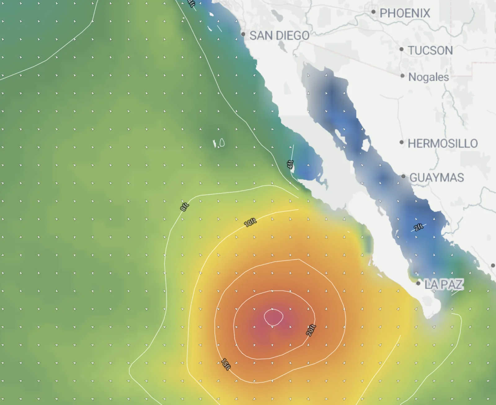
It's too early for spot numbers, so treat this section as an outlook rather than a call. Polo's swell doesn't start aiming at Southern California until it makes the turn, and that Saturday position near 18°N 111°W is still roughly a thousand miles from the coast — about two days of travel for long-period energy. The earliest any of it shows up is early next week, and only if Polo is still a major hurricane when it gets there. We'll put numbers on it once the track and intensity settle.
The geometry is the thing to watch. Right now Polo sits far enough south and east that most of its energy is aimed into the Mexican mainland rather than up the coast. As it walks northwest through the week toward that Saturday position near 18°N 111°W, the angle into the Southern California swell window opens up — and a storm that size, moving that direction, is exactly the kind that produces a real south swell.
One more forming
NHC also notes an area of low pressure expected to form in the next few days south of the Gulf of Tehuantepec. Conditions should be favorable for gradual development, and a tropical depression could form late this week or this weekend, moving slowly west-northwestward to northwestward, parallel to the coast of southern and southwestern Mexico.
The East Pacific is not done.
Storm data from the National Hurricane Center, current as of 16:05 UTC Tuesday, September 22. Track the swell in Fetch as Polo turns.